|
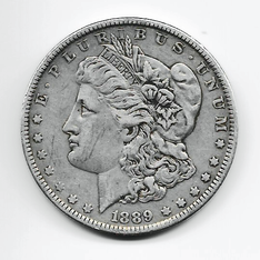
1889
A COMMUNITY CALLED "MONEY," THEN RENAMED "ETOWAH" While the name "Etowah" came about as a result of the building of the train station (aka, depot) in 1895, it is the first official post office created on May 24, 1889 that establishes the year of origin for this community. |
|
How does history identify the year of origin to mark the beginning of a community?
Is it a small group of farms in proximity to one another? the first church? the first school? the first cemetery? the first general store? the first post office? the building of a train station? At what point in the story does one say, this is the beginning of our community? And with what supporting material or documentation? In the case of a rural community where there is no official governing town or village charter, the establishment of a post office is accepted by most historians as the point of origin for the community. In these early times, a community's post office was usually located inside a home or a general store. Perhaps it was a locked cabinet, a closet, or a chest. And the location of the post office changed with each successive postmaster to wherever that person lived or worked. In order for a postmaster to be appointed, some degree of community already had to be present. In other words, a number of farming households in proximity to one another had become established over time. |
How old is Etowah?
What do we know about the origins of the Henderson County community we call "Etowah"? For ten years, from 1889 to 1898, the community's first post office was called "Money." 1889 Money Post Office, the community's first post office located along Brickyard Road and first postmaster, James A. Collins (1848-1929), appointed May 24, 1889. 1895 Train Depot built and named "Money," then changed to "Etowah." The Hendersonville & Brevard Railway Company built the train station in 1895, named it Money by default, and then changed the name to Etowah, most likely within the year. No company record of the name change has been found to date. 1898 Post Office was officially re-named "Etowah" on March 30, 1898. P. O. located in a store owned by John W. Jeudwine (possibly along Etowah School Road near Misty Mountain Drive, to be verified). By 1898, when the U.S. Post Office changed the name, the Money Post Office had already had four different postmasters (Collins, O. Greer, H. Greer, J. Laughter) and had moved several times as the postmaster changed. |
|
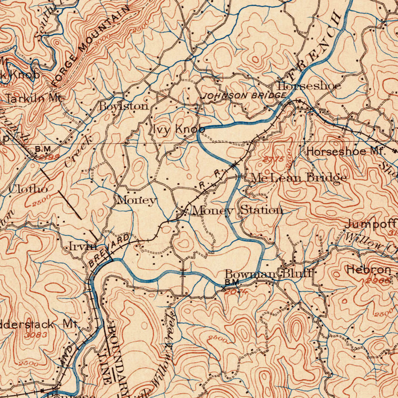
1899 - Money and Money Station (train depot) Two USGS surveys completed in 1888 and 1896 formed the basis for the above 1899 Pisgah Quadrangle Map. Also depicted, the MCLean Bridge and the former name of Blantyre, "Irvin." |
1889 Silver Dollar
|
|
What do we know about the first postmaster James A. Collins (1848 - 1929)?
Born 13 February 1848 in Franklin County, North Carolina Died 4 July, 1929 in Seneca, South Carolina Buried in Mountain View Cemetery, Seneca SC Collins served in the Union Army during the Civil War - Co. B, 10 Tennessee Cav. He married Margaret 'Maggie' F Hollingsworth. Maggie died in 1898. She is buried in the Davidson River Cemetery (to be verified). In February 1888, Collins purchased 125 acres "lying on either side of Burn's Creek" from J. L. Gash and W. A. Gash, Exec. of L. S. Gash and M. A. Gash. (Henderson County Deed Book 24, page 164.) He sold that same parcel in 1899 to F. W. Nicholson, about a year after Maggie died. (Deed Book 39, page 44). Prior to 1889, the beginnings of community in the general area of the Money Post Office: - Early 1800s - John and Jane Clayton Orr built their home and farm along what is now Etowah School Road. - Burns Creek (1830), Hopewell (1868) and Oak Forest (1876) schools were built. - Pleasant Grove (1859) and Old Beulah Baptist Churches (1815) were established. - Alfred Raney and Mary Livingston Gash, married 1829, farm and home was located along Gash Rd (off Holly Springs Rd / Turnpike Rd). - The Robert Thomas family homestead was across the river in the 1860s or earlier. - Early graves in the Oak Forest Cemetery date from 1876, 1884, 1886, 1893 (2), 1894, 1895. - 1883 - Nearby, Bowman's Bluff postmaster, William Hamilton Blythe, was appointed in December 1883. The Welsh Colony was established, arriving sometime in the 1870 - 1880s. - Between 1870 and 1890, on both sides of Old 64, a number of homesteads were well established around the Money Post Office locations. |
|
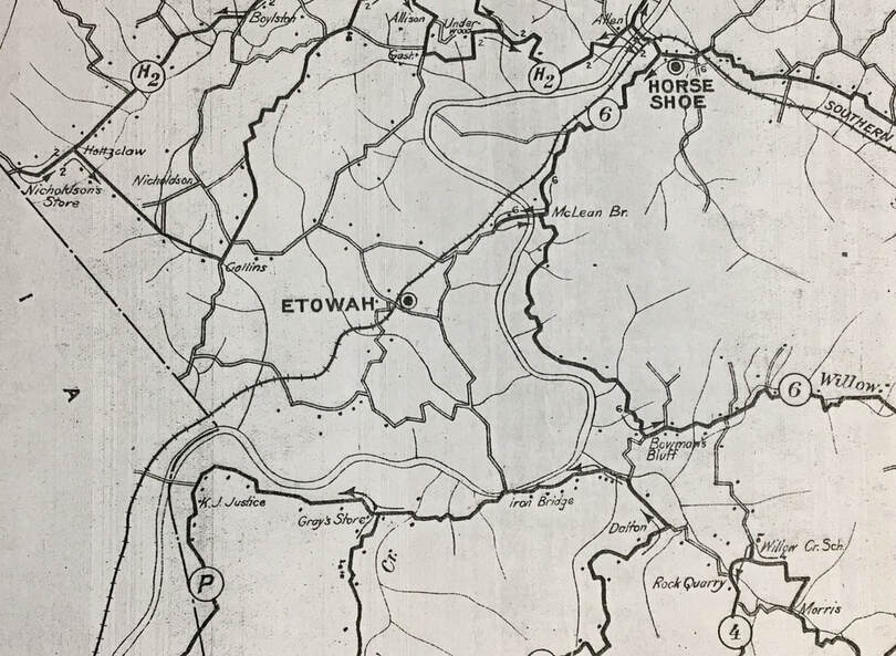
The above 1913 map of Rural Delivery Routes above shows the approximate location of the Collins property on the road known today as Brickyard Road.
Image excerpt from the county map, Henderson County Rural Delivery Routes, dated 1913. (Henderson County Genealogical & Historical Society, Inc.) |
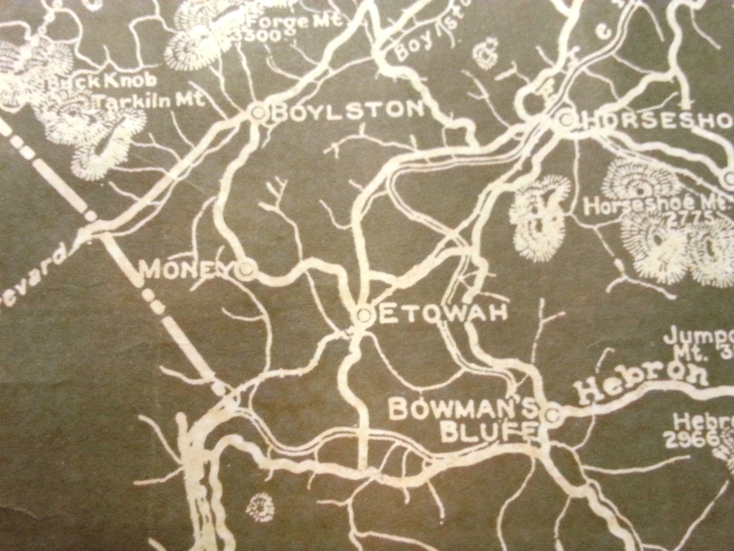
A close-up from the 1918 Henderson County map, showing both Etowah and Money. This 1918 map shows the general location of both Etowah, Money, Bowman's Bluff and the Henderson/Transylvania county line. Map by Geo. Kershaw, Eng'r & Surveyor. Courtesy of
Henderson County Genealogical & Historical Society.
|
About "Money"
From Lenoir Ray's 1970 book, "Postmarks," pg. 299-300 "James A. Collins either had a wry sense of humor or was obsessed with one subject when he named his post office Money on May 24, 1889." "Postmaster Collins operated a store about two miles north of the present site of Etowah." Ray's account goes on to state that Collins was postmaster for three years. He was then succeeded by Ozark K. Greer on April 6, 1892, adding that the Greers "operated a store about where the new Etowah Golf Course is located today" [along Brickyard Road]. After the Greers (including mother Rebecca) Ray writes that "he [Joshua Laughter] moved the office a little closer to the present Etowah [1970] location. He also operated a store in conjunction with the office." |
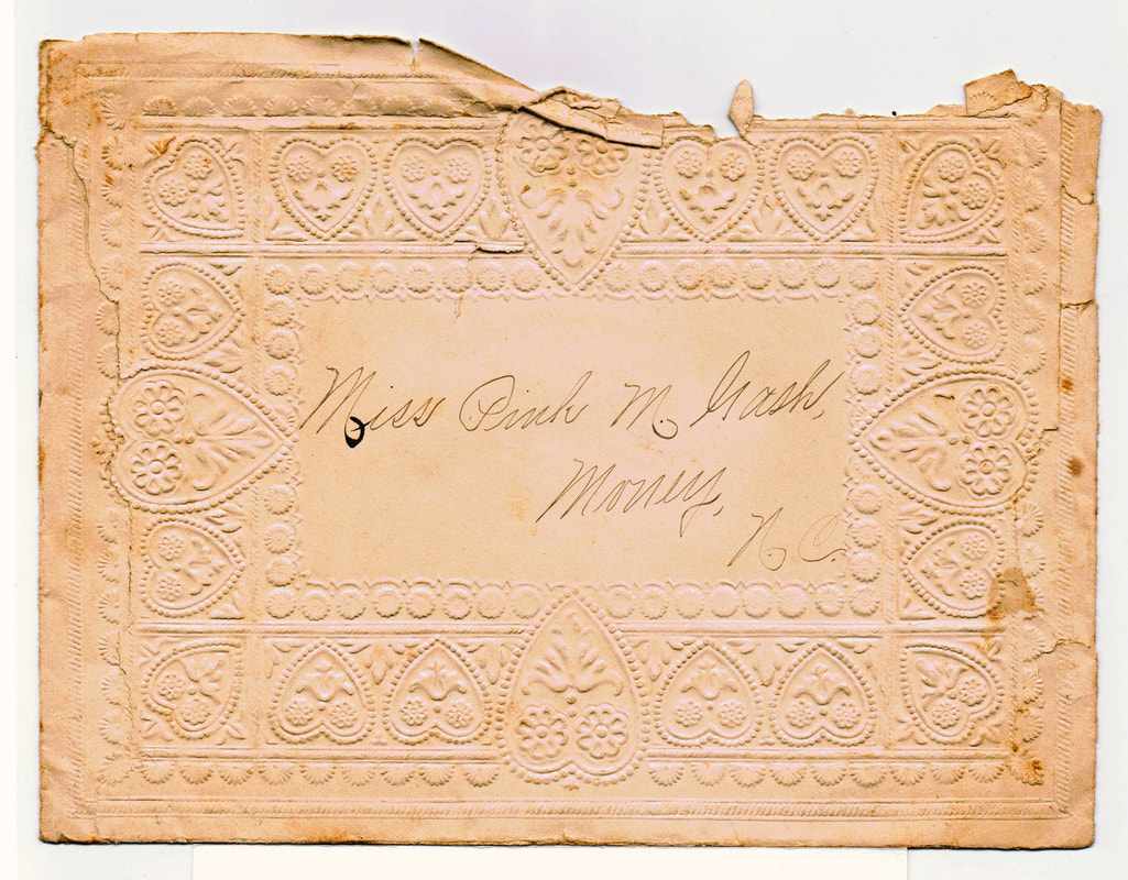
Envelope addressed to Pink Gash, Money - date unknown
|
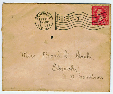
Postmark 1899 - Etowah NC
|
|
Sources for this page include: 1. Various Maps (identified in map captions) 2. U.S.Postal Records on postmaster appointments (National Archives Records: "Appointment of Postmasters, 1832-1971" - microfilm images on ancestry.com) 3. "Postmarks," by Lenoir Ray, published 1970 4. Pearl Gash's (1883 - 1971) "History of Etowah P.O.," written 1956. 5. Records on James A. Collins from ancestry.com and Henderson County Deed Books |